1864 Military Map of New Mexico – Horn & Wallace Framed Reproduction View Watchlist >
- Winning Bid: $220.00
- 49 Bid(s) View Bid History
- High Bidder: natashaf
Seller Accepts Credit Cards
Payment and pickup instructions will be available on your invoice (under "My Account") at the conclusion of this auction.
Lot # B529
System ID # 26594097
Start Date
End Date
10 Watching
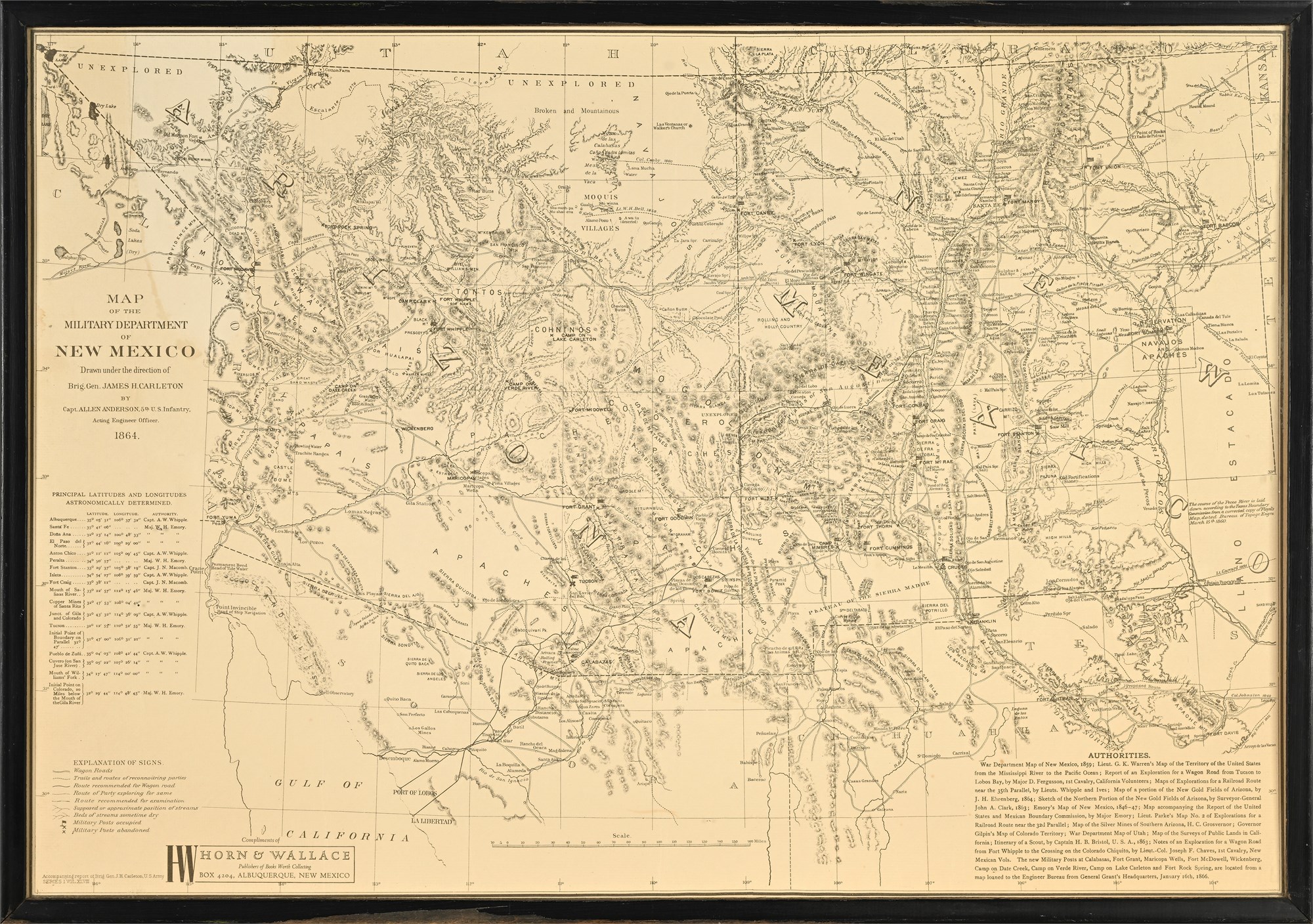
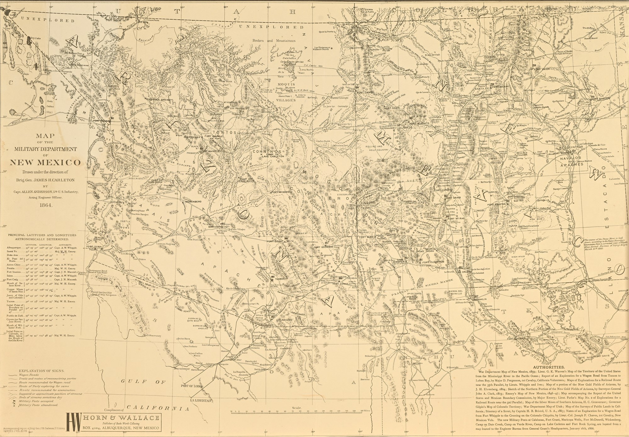
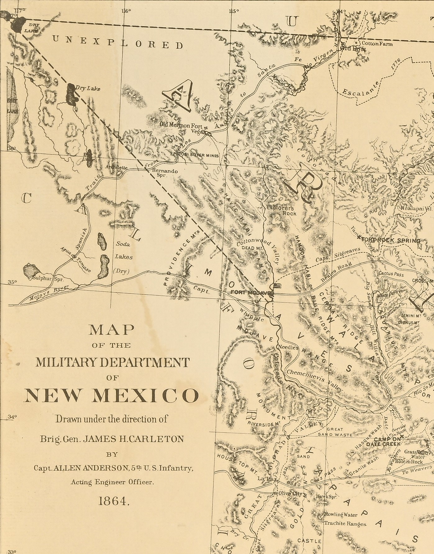
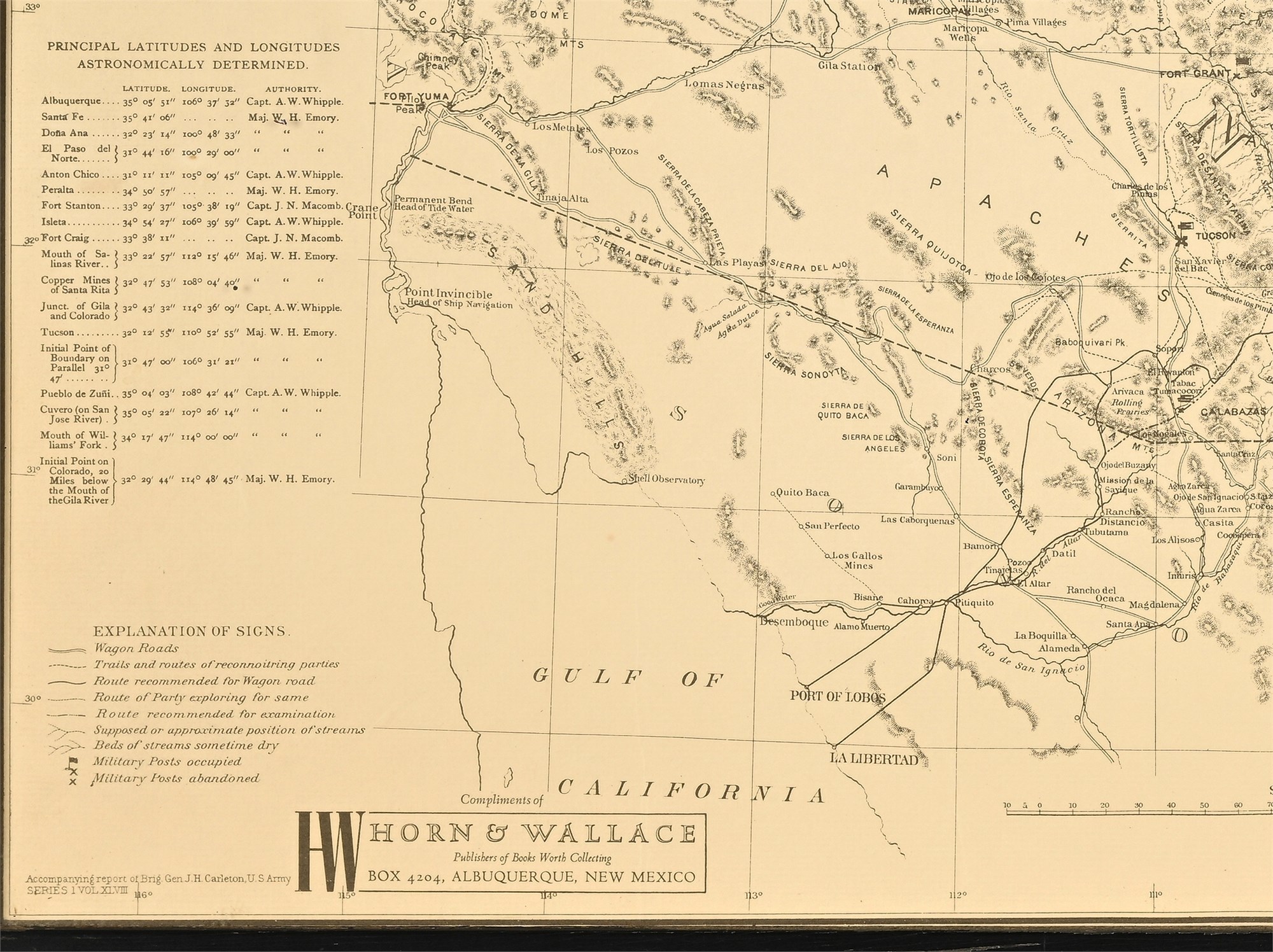
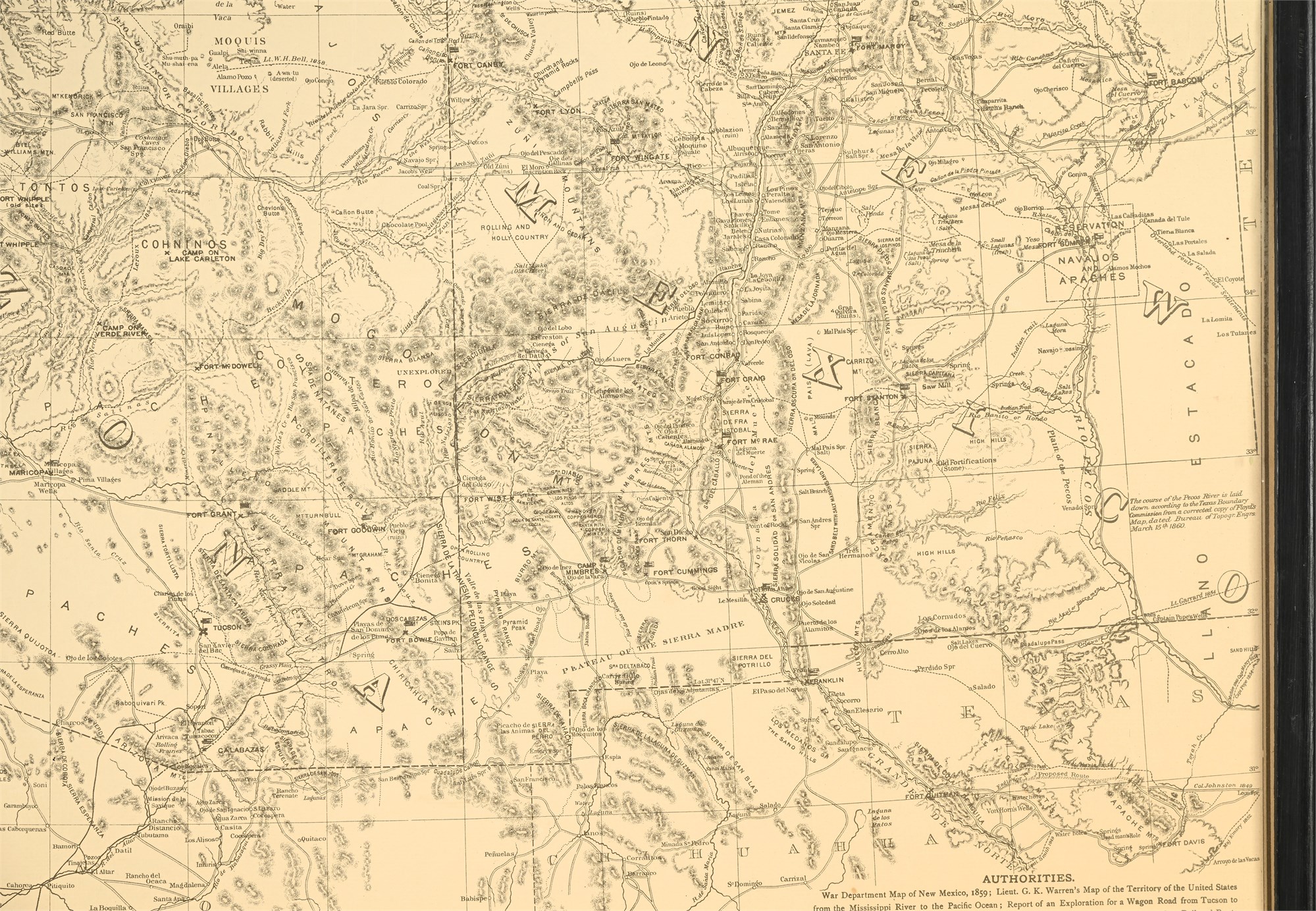
1864 Military Map of New Mexico – Horn & Wallace Framed Reproduction
Framed reproduction of the Map of the Military Department of New Mexico, originally drawn in 1864 under Brig. Gen. James H. Carleton and Capt. Allen Anderson, 5th U.S. Infantry. This map was produced during the Civil War to document military forts, territorial boundaries, Indigenous lands, and geographic features critical to U.S. military operations in the Southwest. It was later officially published in the Atlas to Accompany the Official Records of the Union and Confederate Armies by the U.S. Government Printing Office in the 1890s.
This later reproduction was issued by Horn & Wallace, a mid-20th century Albuquerque publisher known for quality facsimiles of regional maps. The piece displays detailed engravings of forts, routes, tribal regions, and topography stretching across present-day New Mexico, Arizona, Texas, and portions of Utah and California. Notable labels include “Unexplored” areas and historical place names such as “Old Mormon Fort,” “Comanche Country,” and “Apache Pass.”
A compelling educational artifact or décor piece, rich in frontier and Civil War-era geography.
Condition:
Fair condition overall. The wood frame exhibits chipped paint throughout. The map shows visible toning consistent with age and some water damage is present on the upper rear and top left corner (visible from the front). Glass is intact and the map remains fully legible with strong visual presence.
Dimensions:
17.25 x 24.75 x 0.5 inches